NREL's National Solar Radiation Database (NSRD) |
  
|
NREL's National Solar Radiation Database (NSRD) |
|
(Go directly to Importing NREL NSRD Data)
NREL's NSRDB web site proposes several forms of
meteorological data for the US territories :
·Ground
stations data files in the form of Typical Meteorological
Year (TMY).
They can also be obtained as a single zip file or on a CD-ROM.
TMYs are data sets of hourly
values of solar radiation and meteorological elements for
the (1961-1990) period and for the (1991-2005) period. A revised
set exists for the (1991-2010) period with fewer data but more
precision. Those data are labelled "Old data" or "Archive".
Interpolated hourly data files can
be generated for any place in the US for
each year of the original data sets using NREL on-line
Viewer.
·Satellite
derived data for the (1998-2012) period, in the form of Typical
Meteorological Year (TMY)
or annual data within the time
coverage, interpolated for any place in the US through the
Viewer. Those data are 30-mn data files (see Details of the method below).
Data covers useful information for PVSyst:
·Global horizontal irradiance (GHI or GlobHor)
·Diffuse horizontal irradiance (DiffHor)
·Direct normal irradiance (DNI or BeamNor)
·Wind Speed
·Temperature
·Aerosol Optical Depth (AOD) - to be used in the future by PVSYST
·Precipitable water (pw) - to be used in the future by PVSYST
The service is available for
free.
Time-sets
and file formats :
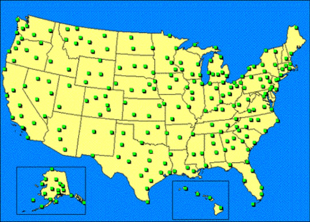
·MTS1: 1961-1990 dataset : available as TMY2 files, 239 ground stations, hourly values. Follow the link for more information.
·MTS2:
1991-2005 dataset :
available as TMY3 files, 1454 ground stations, hourly values. Please note
that the TMY3 format as been revisited on January 2015. TMY3 files
may be converted into TM2 files using an executable available on
the site. Follow the
link for more information.
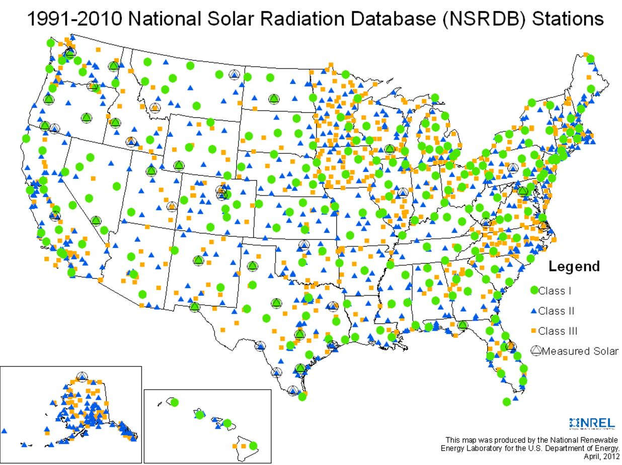
·MTS3: 1991-2010 dataset: available in ASCII comma delimited files, this NSRDB release contains less than 1% measured data of the records. It differs from the 1991-2005 data due to the several changes, more info at http://www.nrel.gov/docs/fy12osti/54824.pdf. Follow the link for more information.
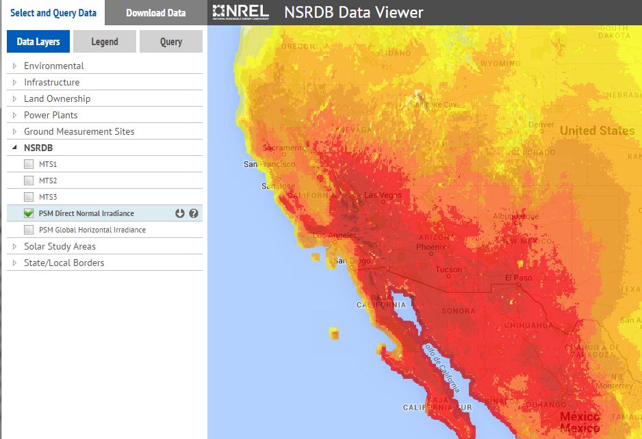
·PSM:
2005-2012 data : available in the
new NREL standard file format as
csv files, 30 minutes solar data derived from
GOES satellites using NREL's PSM methodology (see
below), 4kmx4km spatial resolution. The area covered is bordered by
longitudes -25° E on the eastern side and -175° E on the west; and
by latitudes 5° N on the south and 60° N on the northern edge.
Available through the Viewer.
Details of the Method
·TMY data sets
TMY data sets are juxtapositions of months or periods of real data, chosen in the multi-year data set in such a way that they represent a typical 1-year period. Their intended use is for computer simulations of solar energy conversion systems and building systems to facilitate performance comparisons of different system types, configurations, and locations in the United States and its territories. Because they represent typical rather than extreme conditions, they are not suited for designing systems to meet the worst-case conditions occurring at a location.
·NREL Physical Solar Model
The Physical Solar Model (PSM) developed by NREL in collaboration with the University of Wisconsin and the National Oceanic and Atmospheric Administration (NOAA) computes global horizontal irradiance (GHI) using the visible and infrared channel measurements from the Geostationary Operational Environmental Satellites (GOES) system. PSM uses a two-stage scheme that first retrieves cloud properties and then uses those properties to calculate surface radiation. The cloud properties in PSM are generated using the AVHRR Pathfinder Atmospheres-Extended (PATMOS-x) algorithms. Using the cloud mask from PATMOS-x, and aerosol optical depth (AOD) and precipitable water vapor (PWV) from ancillary sources, the direct normal irradiance (DNI) and GHI are computed for clear-sky conditions using the MMAC model. For cloud scenes identified by the cloud mask, the Satellite Algorithm for Surface Radiation Budget (SASRAB) is used to compute the GHI. The DNI for cloud scenes is then computed using the DISC model.
Example: SAM data for India
As an example, data for 9 stations in India, (elaborated by NREL from the SUNY satellite), are now available for several years (2004-2008) at the NREL web site.